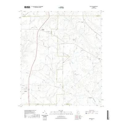
2020 Map of Bluffton
USGS Topo · Published 2020About this map
Agricultural lands and creek drainages define this portion of Southwest Georgia where the boundaries of Calhoun, Clay, Early, and Randolph counties converge. The town of Bluffton anchors the southwest corner, while the larger settlement of Edison sits on the eastern edge, connected by a network of rural roads such as Bass Rd and Co Rd 130. The landscape is etched by numerous watercourses including Spring Creek, Williams Creek, and Little Pachitla Cr, which feed into local basins like Faines Lake.
Find a feature on this map
83 named features on this map. Tap any name to fly to it.
Don’t see what you’re looking for? This feature index may not catch every label — zoom into the map to look around manually.
Map Details
Editions of this 2020 Bluffton Map
This is the sole edition of this map. No revisions or reprints were ever made.
Other maps of this area

1953 · Dothan
USGS Topo · 1:250,000

1954 · Dothan
USGS Topo · 1:250,000

1955 · Dothan
USGS Topo · 1:250,000

1973 · Martins Crossroads
USGS Topo · 1:24,000
1973 · Coleman
USGS Topo · 1:24,000

1973 · Blakely North
USGS Topo · 1:24,000

1973 · Bancroft
USGS Topo · 1:24,000

1973 · Edison
USGS Topo · 1:24,000
1973 · Carnegie
USGS Topo · 1:24,000
1973 · Bluffton
USGS Topo · 1:24,000