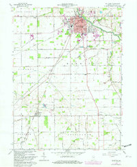
1962 Map of Bluffton
USGS Topo · Published 1982About this map
The Wabash River serves as the geographic anchor for this part of Wells County, as seen in a survey based on early 1960s field data with updates from 1979. The city of Bluffton dominates the northern landscape, characterized by its dense grid of streets, City Hall, and several municipal parks including Jefferson Park and Wiley Park. South of the city, the land transition to a well-organized agricultural system defined by a network of numbered section roads and drainage features like Neff Ditch and Popejoy Ditch. Small, isolated settlements such as Wellsburg, Poneto, and Reiffsburg are scattered along these rural routes, often centered near community landmarks like Prairie Ch or Stahl Cem. The Norfolk and Western Railway cuts diagonally through the townships of Lancaster, Harrison, and Liberty, illustrating the rail-dependent transport patterns that connected these farming communities to the regional hub at Bluffton.
Find a feature on this map
66 named features on this map. Tap any name to fly to it.
Don’t see what you’re looking for? This feature index may not catch every label — zoom into the map to look around manually.
Map Details
Editions of this 1962 Bluffton Map
3 editions found
Other maps of this area

1953 · Muncie
USGS Topo · 1:250,000

1955 · Markle
USGS Topo · 1:24,000

1956 · Muncie
USGS Topo · 1:250,000

1962 · Uniondale
USGS Topo · 1:24,000

1962 · Montpelier
USGS Topo · 1:24,000

1962 · Liberty Center
USGS Topo · 1:24,000

1962 · Preble
USGS Topo · 1:24,000

1962 · Petroleum
USGS Topo · 1:24,000

1962 · Linn Grove
USGS Topo · 1:24,000
1962 · Domestic
USGS Topo · 1:24,000