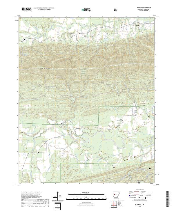
2024 Map of Bluffton
USGS Topo · Published 2024About this map
The Fourche LaFave River valley anchors the southern half of this Yell County landscape, where the settlement of Bluffton and its namesake Bluffton Cem overlook the winding watercourse. To the north, the massive profile of Dutch Creek Mountain dominates the terrain, separating the river valley from the drainage of Dutch Creek. Small community clusters like Waltreak and Chalybeate Springs are connected by a network of rural routes including State Hwy 80 and several forest roads. This area is heavily defined by the boundaries of the Ouachita National Forest, showing a distinct transition from the private agricultural plots near Pleasant Hill to the protected timberlands that cover the ridges. Notable local landmarks like Briggs Memorial Park and the Catlett Farms Airport sit in the eastern flats, while genealogically significant sites like Waltreak Cem provide historical touchpoints for the region's early residents.
Find a feature on this map
58 named features on this map. Tap any name to fly to it.
Don’t see what you’re looking for? This feature index may not catch every label — zoom into the map to look around manually.
Map Details
Editions of this 2024 Bluffton Map
This is the sole edition of this map. No revisions or reprints were ever made.
Other maps of this area

1879 · Mountain Home
USGS Topo · 1:62,500

1887 · Magazine Mountain #4
USGS Topo · 1:62,500

1887 · Magazine Mountain
USGS Topo · 1:62,500

1888 · Dardanelle #3
USGS Topo · 1:62,500

1890 · Magazine Mountain
USGS Topo · 1:125,000

1890 · Mount Ida
USGS Topo · 1:125,000

1890 · Hot Springs
USGS Topo · 1:125,000

1890 · Dardanelle
USGS Topo · 1:125,000

1894 · Hot Springs
USGS Topo · 1:125,000

1955 · Little Rock
USGS Topo · 1:250,000