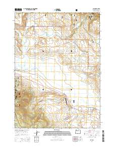
2014 Map of Bly
USGS Topo · Published 2014About this map
Bly serves as a central hub in this landscape of the upper Klamath Basin, situated where Or-140 meets local routes like Edler St and Gerber St. The area is defined by its complex water systems, with the Sprague River and its various branches, including the South Fork Sprague River and North Fork Sprague River, winding through the valley. This 2014 survey reveals an economy and lifestyle tied to the land, evidenced by Allen's Airstrip and numerous water management features such as North Fork Ditch and Elder Ditch.
Find a feature on this map
48 named features on this map. Tap any name to fly to it.
Don’t see what you’re looking for? This feature index may not catch every label — zoom into the map to look around manually.
Map Details
Editions of this 2014 Bly Map
This is the sole edition of this map. No revisions or reprints were ever made.
Other maps of this area

1889 · Klamath
USGS Topo · 1:250,000

1894 · Klamath
USGS Topo · 1:250,000

1955 · Klamath Falls
USGS Topo · 1:250,000

1958 · Klamath Falls
USGS Topo · 1:250,000

1960 · Riverbed Butte
USGS Topo · 1:62,500

1960 · Bly
USGS Topo · 1:62,500

1960 · Fishhole Mtn
USGS Topo · 1:62,500

1966 · Sandhill Crossing
USGS Topo · 1:24,000

1974 · Lake Abert
USGS Topo · 1:100,000

1975 · Lakeview
USGS Topo · 1:100,000