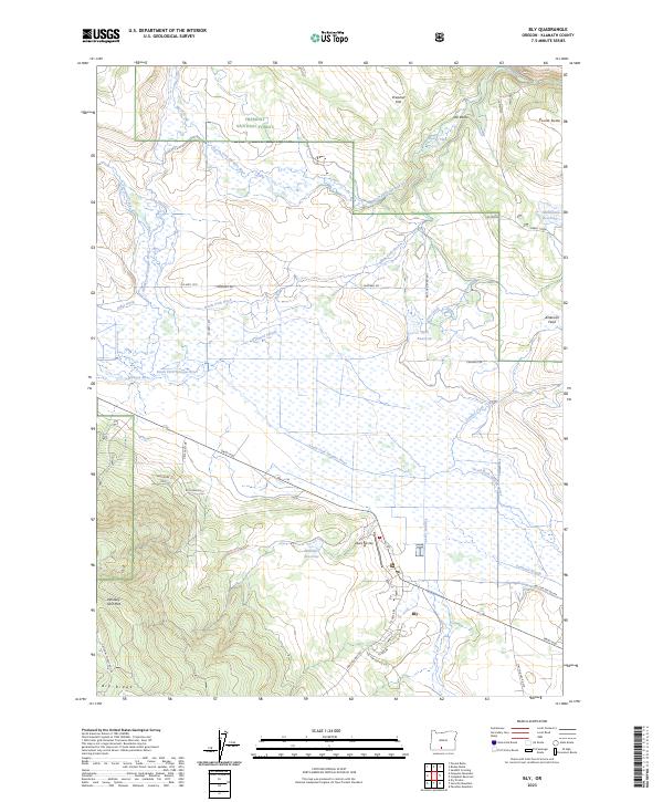
2023 Map of Bly
USGS Topo · Published 2023About this map
The settlement of Bly serves as a central hub in this high-desert landscape, situated where the South Fork Sprague River meets the Sprague River. This modern survey reveals a complex network of water management, including the North Fork Ditch, Elder Ditch, and Obenchain Reservoir, which support the agricultural activity surrounding the town. To the north, the Fremont National Forest encompasses timberlands and distinctive terrain features like The Elbow and Preacher Flat.
Find a feature on this map
46 named features on this map. Tap any name to fly to it.
Don’t see what you’re looking for? This feature index may not catch every label — zoom into the map to look around manually.
Map Details
Editions of this 2023 Bly Map
This is the sole edition of this map. No revisions or reprints were ever made.
Other maps of this area

1889 · Klamath
USGS Topo · 1:250,000

1894 · Klamath
USGS Topo · 1:250,000

1955 · Klamath Falls
USGS Topo · 1:250,000

1958 · Klamath Falls
USGS Topo · 1:250,000

1960 · Riverbed Butte
USGS Topo · 1:62,500

1960 · Bly
USGS Topo · 1:62,500

1960 · Fishhole Mtn
USGS Topo · 1:62,500

1966 · Sandhill Crossing
USGS Topo · 1:24,000

1974 · Lake Abert
USGS Topo · 1:100,000

1975 · Lakeview
USGS Topo · 1:100,000