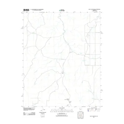
2011 Map of Blye Canyon NE
USGS Topo · Published 2011About this map
Dennys Ranch and the X Bar One Ranch define the sparse settlement pattern of this Yavapai County landscape, where water security is dictated by a network of catchments. The drainage of Truxton Wash snakes across the terrain, serving as the primary geographical anchor for various access roads and ranching outposts. This 2011 survey reveals an environment organized around the livestock industry, with numerous named water features such as Antelope Tank, Red Rock Tank, and Last Chance Tank providing the necessary resources for remote operations.
Find a feature on this map
32 named features on this map. Tap any name to fly to it.
Don’t see what you’re looking for? This feature index may not catch every label — zoom into the map to look around manually.
Map Details
Editions of this 2011 Blye Canyon NE Map
This is the sole edition of this map. No revisions or reprints were ever made.
Other maps of this area

1886 · Diamond Creek
USGS Topo · 1:250,000

1892 · Diamond Creek
USGS Topo · 1:250,000

1948 · Williams
USGS Topo · 1:250,000

1954 · Williams
USGS Topo · 1:250,000

1956 · Williams
USGS Topo · 1:250,000

1960 · Williams
USGS Topo · 1:250,000

1961 · Williams
USGS Topo · 1:250,000

1967 · Peach Springs
USGS Topo · 1:24,000
1967 · Nelson
USGS Topo · 1:24,000
1980 · Cherokee Point
USGS Topo · 1:24,000