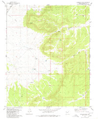
1980 Map of Cherokee Point
USGS Topo · Published 1980About this map
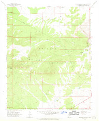
The Hualapai Indian Reservation dominates the northern reaches of this high-desert landscape, where the land rises toward the prominent Cherokee Point. This 1980 survey captures a territory defined by the logistical needs of cattle ranching and heavy transit, with the Atchison Topeka and Santa Fe railroad cutting across the northwestern corner alongside Truxton Wash. The map reveals a sophisticated network of water management for livestock, documented through numerous named catchments such as North Blye Tank, South Blye Tank, and End Water Corral. Deep erosional features like Rock Canyon and Blue Tank Canyon score the terrain, illustrating the drainage patterns that feed into Cherokee Wash. This document provides an essential record of land use and water infrastructure within Mohave County at the start of the 1980s.
Find a feature on this map
21 named features on this map. Tap any name to fly to it.
Don’t see what you’re looking for? This feature index may not catch every label — zoom into the map to look around manually.
Map Details
Editions of this 1980 Cherokee Point Map
This is the sole edition of this map. No revisions or reprints were ever made.
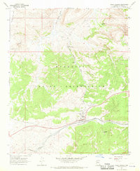
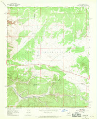
Other maps of this area

1886 · Diamond Creek
USGS Topo · 1:250,000

1892 · Diamond Creek
USGS Topo · 1:250,000

1948 · Williams
USGS Topo · 1:250,000

1954 · Williams
USGS Topo · 1:250,000

1956 · Williams
USGS Topo · 1:250,000

1960 · Williams
USGS Topo · 1:250,000

1961 · Williams
USGS Topo · 1:250,000
1967 · Milkweed Canyon SE
USGS Topo · 1:24,000
1967 · Peach Springs
USGS Topo · 1:24,000
1967 · Nelson
USGS Topo · 1:24,000