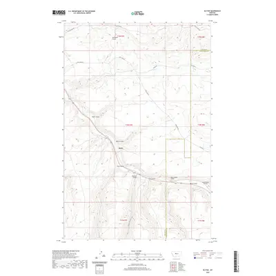
2020 Map of Blythe
USGS Topo · Published 2020About this map
Blythe sits at the center of this 2020 landscape, where the high plains of central Montana are deeply incised by a complex network of coulees. The terrain is defined by dramatic drainage patterns, notably where Big Otter Cr winds through the southern portion of the quadrangle, joined by secondary features like Never Sweat Coulee and Swan Coulee. The topography here reflects the characteristic erosion of the region, creating a series of ridges and draws that historically dictated the routes of travel and settlement.
Find a feature on this map
24 named features on this map. Tap any name to fly to it.
Don’t see what you’re looking for? This feature index may not catch every label — zoom into the map to look around manually.
Map Details
Editions of this 2020 Blythe Map
This is the sole edition of this map. No revisions or reprints were ever made.
Other maps of this area

1890 · Fort Benton
USGS Topo · 1:250,000

1892 · Fort Benton
USGS Topo · 1:250,000

1897 · Fort Benton
USGS Topo · 1:250,000

1954 · Great Falls
USGS Topo · 1:250,000

1956 · Belt
USGS Topo · 1:62,500

1957 · Great Falls
USGS Topo · 1:250,000
1961 · Limestone Butte
USGS Topo · 1:24,000

1961 · Barker
USGS Topo · 1:62,500
1967 · Monarch NE
USGS Topo · 1:24,000
1967 · Riceville
USGS Topo · 1:24,000