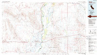
1986 Map of Blythe
USGS Topo · Published 1986About this map
The Colorado River serves as the central axis of this mid-1980s landscape, carving through the Palo Verde Valley and forming the boundary between California and Arizona. Agriculture and river-dependent settlement dominate the valley floor, where towns like Blythe, East Blythe, and Ripley are organized within a grid of irrigation and transport. To the east, the Colorado River Indian Reservation spans the Parker Valley, while the terrain rises sharply into the Dome Rock Mountains and Plomosa Mountains.
Find a feature on this map
77 named features on this map. Tap any name to fly to it.
Don’t see what you’re looking for? This feature index may not catch every label — zoom into the map to look around manually.
Map Details
Editions of this 1986 Blythe Map
3 editions found
Other maps of this area

1911 · Parker
USGS Topo · 1:125,000

1923 · Signal
USGS Topo · 1:250,000

1930 · Linskey
USGS Topo · 1:62,500

1931 · Moon Mtn
USGS Topo · 1:62,500

1932 · Moon Mtn
USGS Topo · 1:62,500

1933 · Cunningham Mtn
USGS Topo · 1:48,000

1934 · Trigo Peaks
USGS Topo · 1:48,000

1939 · Trigo Peaks
USGS Topo · 1:62,500

1940 · Dome Rock Mts
USGS Topo · 1:62,500

1942 · Signal
USGS Topo · 1:250,000