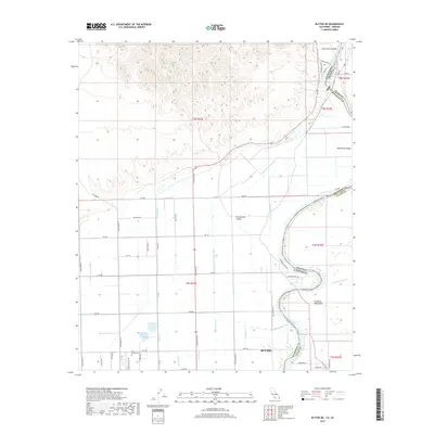
2018 Map of Blythe NE
USGS Topo · Published 2018About this map
Palo Verde Valley agriculture and the engineered hydraulics of the lower Colorado River dominate this landscape near the California-Arizona border. The sophisticated irrigation network is anchored by the Palo Verde Intake in the northeast, feeding a complex system of waterways including the Main Canal, Duplicate Main Canal, and numerous numbered laterals like the D-10 Canal. This infrastructure transformed the arid desert floor into a productive basin, supporting the growth of Blythe and providing the backbone for the local economy.
Find a feature on this map
51 named features on this map. Tap any name to fly to it.
Don’t see what you’re looking for? This feature index may not catch every label — zoom into the map to look around manually.
Map Details
Editions of this 2018 Blythe NE Map
This is the sole edition of this map. No revisions or reprints were ever made.
Other maps of this area

1931 · Moon Mtn
USGS Topo · 1:62,500

1932 · Moon Mtn
USGS Topo · 1:62,500

1933 · Cunningham Mtn
USGS Topo · 1:48,000

1940 · Dome Rock Mts
USGS Topo · 1:62,500

1942 · Blythe
USGS Topo · 1:250,000

1942 · MOON MTN
USGS Topo · 1:62,500

1945 · Big Maria Mtns
USGS Topo · 1:62,500

1951 · Big Maria Mts
USGS Topo · 1:62,500

1951 · Blythe
USGS Topo · 1:24,000

1951 · McCoy Wash
USGS Topo · 1:24,000