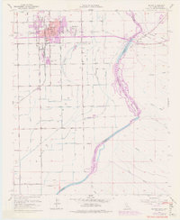
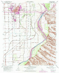
1951 Map of Blythe
USGS Topo · Published 1977About this map
The Colorado River serves as the primary boundary and lifeline for this desert region, dividing the growing agricultural and civic hub of Blythe, California, from the riverside settlement of Ehrenberg, Arizona. The town plan of Blythe shows significant mid-century development including Palo Verde Hospital, a High Sch, and the local Cem. Transport is dominated by the Atchison Topeka and Santa Fe railroad and the Ehrenberg Bridge, which links the two states.
Find a feature on this map
50 named features on this map. Tap any name to fly to it.
Don’t see what you’re looking for? This feature index may not catch every label — zoom into the map to look around manually.
Map Details
Editions of this 1951 Blythe Map
6 editions found
Other maps of this area

1933 · Cunningham Mtn
USGS Topo · 1:48,000

1934 · Trigo Peaks
USGS Topo · 1:48,000

1939 · Trigo Peaks
USGS Topo · 1:62,500

1940 · Dome Rock Mts
USGS Topo · 1:62,500

1942 · Blythe
USGS Topo · 1:250,000

1945 · Cibola
USGS Topo · 1:62,500

1951 · Blythe
USGS Topo · 1:24,000

1951 · McCoy Wash
USGS Topo · 1:24,000

1951 · Blythe NE
USGS Topo · 1:24,000

1951 · Cibola
USGS Topo · 1:62,500