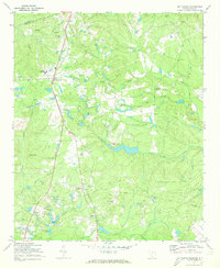
1971 Map of Blythewood
USGS Topo · Published 1973About this map
The town of Blythewood and the northern outskirts of the Columbia area are captured here during a period of transition in the early 1970s. The Southern railroad line and U.S. Highway 21 serve as the primary north-south corridor, connecting the rural communities of Langfords Crossroads and Killian. The landscape is dotted with small-scale industries and local landmarks, including several sandpits and the Columbia Country Club situated near Rice Creek.
Find a feature on this map
45 named features on this map. Tap any name to fly to it.
Don’t see what you’re looking for? This feature index may not catch every label — zoom into the map to look around manually.
Map Details
Editions of this 1971 Blythewood Map
2 editions found
Other maps of this area

1904 · Columbia
USGS Topo · 1:125,000

1935 · Killian
USGS Topo · 1:48,000

1937 · Killian
USGS Topo · 1:62,500

1941 · Spartanburg
USGS Topo · 1:250,000

1942 · Camden
USGS Topo · 1:125,000

1947 · Columbia North
USGS Topo · 1:24,000

1948 · Columbia North
USGS Topo · 1:24,000

1949 · Irmo NE
USGS Topo · 1:24,000

1953 · Messers Pond
USGS Topo · 1:24,000

1953 · Blythewood
USGS Topo · 1:24,000