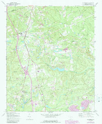
1971 Map of Blythewood
USGS Topo · Published 1990About this map
Blythewood serves as the focal point of this Richland County landscape, situated where the interstate highway system began to intersect with long-established rural routes. The area is defined by a dense network of tributaries including Twentyfive Mile Creek, Simmons Creek, and Rice Creek, which shaped the early settlement patterns and land use. Local community life is evidenced by numerous houses of worship and education, such as Hanberry Jr High Sch, St Marks Ch, and Bethel Ch.
Find a feature on this map
46 named features on this map. Tap any name to fly to it.
Don’t see what you’re looking for? This feature index may not catch every label — zoom into the map to look around manually.
Map Details
Editions of this 1971 Blythewood Map
2 editions found
Other maps of this area

1904 · Columbia
USGS Topo · 1:125,000

1935 · Killian
USGS Topo · 1:48,000

1937 · Killian
USGS Topo · 1:62,500

1941 · Spartanburg
USGS Topo · 1:250,000

1942 · Camden
USGS Topo · 1:125,000

1947 · Columbia North
USGS Topo · 1:24,000

1948 · Columbia North
USGS Topo · 1:24,000

1949 · Irmo NE
USGS Topo · 1:24,000

1953 · Messers Pond
USGS Topo · 1:24,000

1953 · Blythewood
USGS Topo · 1:24,000