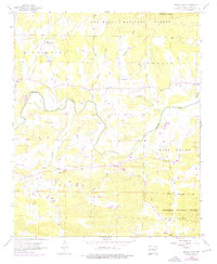
1958 Map of Board Camp
USGS Topo · Published 1976About this map
The Ouachita River meanders through the center of this landscape, carving a valley between the wooded slopes of the Ouachita National Forest. This 1958 survey, updated with 1975 photorevisions, captures the rural character of Polk County as small settlements and family churches remained the social anchors of the region. The community of Board Camp sits at the junction of Board Camp Creek and Macks Creek, while Cherry Hill marks the eastern edge of the sheet. Local landmarks such as Goldsberry Mountain and High Point define the local topography, overlooking a network of tributary waters including Loftis Creek, Southern Creek, and Sulphur Creek. Genealogists will find significant value in the documentation of several rural burial grounds and houses of worship, including Pine Grove Ch, Yocana Ch, Midway Ch, and their associated cemeteries like Liberty Cem. The map also notes a local Gravel Pit, hinting at the area's small-scale extractive activities during the mid-20th century.
Find a feature on this map
32 named features on this map. Tap any name to fly to it.
Don’t see what you’re looking for? This feature index may not catch every label — zoom into the map to look around manually.
Map Details
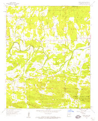
Editions of this 1958 Board Camp Map
2 editions found
Other maps of this area

1890 · Mount Ida
USGS Topo · 1:125,000

1890 · Poteau Mountain
USGS Topo · 1:125,000

1899 · Poteau Mountain
USGS Topo · 1:125,000

1906 · Caddo Gap
USGS Topo · 1:125,000

1913 · De Queen
USGS Topo · 1:125,000

1936 · Athens
USGS Topo · 1:48,000

1942 · Athens
USGS Topo · 1:62,500

1950 · Mcalester
USGS Topo · 1:250,000

1955 · Little Rock
USGS Topo · 1:250,000

1956 · Little Rock
USGS Topo · 1:250,000