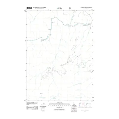
2011 Map of Boardman Creek
USGS Topo · Published 2011About this map
The South Fork Boise River winds through the Sawtooth National Forest area, defining the northern geography of this mountain landscape. In the early 21st century, the terrain is characterized by a network of drainage systems, including Boardman Creek and Big Smoky Creek, which feed into the main river channel. The presence of the Little Smokey Patrol Cabin and multiple recreation sites like Big Smoky Campground and River Bend Campground reflects the area's primary use for forest management and seasonal access. High-elevation features such as Boardman Pass and the Smoky Dome Lakes provide clear landmarks for navigating the high ridges and canyons. Named bars like Jones Bar and Lightfoot Bar along the riverbanks suggest historical river-bottom landmarks used by travelers and packers long before modern forest roads like 227 provided more reliable entry.
Find a feature on this map
26 named features on this map. Tap any name to fly to it.
Don’t see what you’re looking for? This feature index may not catch every label — zoom into the map to look around manually.
Map Details
Editions of this 2011 Boardman Creek Map
This is the sole edition of this map. No revisions or reprints were ever made.
Other maps of this area

1892 · Camas Prairie
USGS Topo · 1:125,000

1893 · Camas Prairie
USGS Topo · 1:125,000

1894 · Rocky Bar
USGS Topo · 1:125,000

1900 · Sawtooth
USGS Topo · 1:125,000

1955 · Hailey
USGS Topo · 1:250,000

1957 · Fairfield
USGS Topo · 1:62,500

1959 · Hailey
USGS Topo · 1:250,000

1962 · Hailey
USGS Topo · 1:250,000

1963 · Deer Mountain
USGS Topo · 1:24,000

1964 · Ross Peak
USGS Topo · 1:24,000