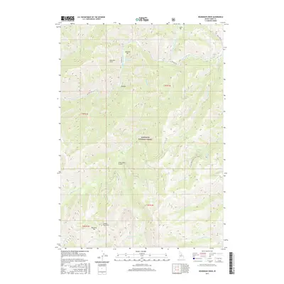
2017 Map of Boardman Creek
USGS Topo · Published 2017About this map
The Soldier Mountains define this high-altitude landscape in the Sawtooth National Forest, where the terrain is carved by the South Fork Boise River and its numerous tributaries. Geothermal activity is noted at Lightfoot Hot Springs near Lightfoot Bar, indicating the subterranean heat of this mountainous region. The hydrological network is complex, with Big Smoky Creek, Boardman Cr, and N Fork Soldier Cr draining the steep slopes. High-elevation features like Boardman Pass and the Smoky Dome Lakes highlight the glacial and volcanic legacy of the area. This map documents a wilderness character maintained into the twenty-first century, showing limited human infrastructure beyond the Big Smoky Rd and Boise River Rd that trace the watercourses.
Find a feature on this map
31 named features on this map. Tap any name to fly to it.
Don’t see what you’re looking for? This feature index may not catch every label — zoom into the map to look around manually.
Map Details
Editions of this 2017 Boardman Creek Map
This is the sole edition of this map. No revisions or reprints were ever made.
Other maps of this area

1892 · Camas Prairie
USGS Topo · 1:125,000

1893 · Camas Prairie
USGS Topo · 1:125,000

1894 · Rocky Bar
USGS Topo · 1:125,000

1900 · Sawtooth
USGS Topo · 1:125,000

1955 · Hailey
USGS Topo · 1:250,000

1957 · Fairfield
USGS Topo · 1:62,500

1959 · Hailey
USGS Topo · 1:250,000

1962 · Hailey
USGS Topo · 1:250,000

1963 · Deer Mountain
USGS Topo · 1:24,000

1964 · Ross Peak
USGS Topo · 1:24,000