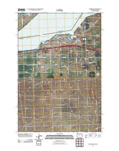
2011 Map of Boardman
USGS Topo · Published 2011About this map
The Columbia River dominates the northern reaches of this landscape, framing the industrial and agricultural hub of Boardman. This era of the town is defined by its strategic position along the water, where the Port of Morrow serves as a center for transport and commerce. Local history is anchored by the Boardman Post Office and two nearby burial grounds, Riverview Cemetery and Boardman Cemetery. The map captures the organized layout of the settlement, with residential and commercial streets like Marine Dr NW and Columbia Ave NE giving way to an extensive network of rural roads such as Kunze Ln and Wilson Rd SW. Further inland, the terrain is marked by geographic features including Juniper Canyon and the navigation ranges of Messinger Lower Range, Messinger Middle Range, and Messinger Upper Range, which guide activity along this critical stretch of the river valley.
Find a feature on this map
47 named features on this map. Tap any name to fly to it.
Don’t see what you’re looking for? This feature index may not catch every label — zoom into the map to look around manually.
Map Details
Editions of this 2011 Boardman Map
This is the sole edition of this map. No revisions or reprints were ever made.
Other maps of this area

1906 · Blalock Island
USGS Topo · 1:125,000

1908 · Blalock Island
USGS Topo · 1:125,000

1953 · Pendleton
USGS Topo · 1:250,000

1956 · Pendleton
USGS Topo · 1:250,000

1962 · Canoe Ridge
USGS Topo · 1:24,000

1962 · Blalock Island
USGS Topo · 1:24,000

1962 · Paterson
USGS Topo · 1:24,000

1962 · Boardman
USGS Topo · 1:24,000

1962 · Clarke
USGS Topo · 1:24,000

1962 · Crow Butte
USGS Topo · 1:24,000