
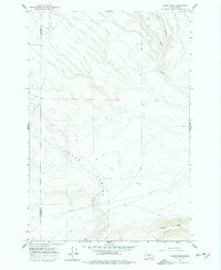
1962 Map of Canoe Ridge
USGS Topo · Published 1963About this map
Dead Canyon cuts a significant path through this arid portion of the Horse Heaven Hills, defining the drainage patterns toward the Columbia River. The landscape is characterized by its high ridges and deep incisions, most notably Canoe Ridge in the south and the winding course of Glade Creek to the northeast. Human presence in the early 1960s was primarily industrial and infrastructural, evidenced by a large Pipeline traversing the southern sections and several water-related sites including a Well and multiple Dry Wells.
Find a feature on this map
9 named features on this map. Tap any name to fly to it.
Don’t see what you’re looking for? This feature index may not catch every label — zoom into the map to look around manually.
Map Details
Editions of this 1962 Canoe Ridge Map
2 editions found
Other maps of this area

1906 · Blalock Island
USGS Topo · 1:125,000

1908 · Blalock Island
USGS Topo · 1:125,000

1915 · Prosser
USGS Topo · 1:125,000

1917 · Prosser
USGS Topo · 1:125,000

1953 · Pendleton
USGS Topo · 1:250,000

1953 · Walla Walla
USGS Topo · 1:250,000

1955 · Prosser SW
USGS Topo · 1:24,000

1956 · Pendleton
USGS Topo · 1:250,000

1958 · Walla Walla
USGS Topo · 1:250,000
1962 · Phinny Hill
USGS Topo · 1:24,000