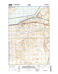
2014 Map of Boardman
USGS Topo · Published 2014About this map
Boardman sits at a geographic crossroads on the southern bank of the Columbia River, where the high desert of Eastern Oregon meets the water. The landscape is defined by the massive expanse of Lake Umatilla, punctuated by Blalock Island and Whitcomb Island. This 2014 survey illustrates the complex relationship between the river and the arid interior, managed through the W Extension Irrigation Canal and the Boardman Canal Ln network. These systems have transformed the terrain south of the town center, allowing for development and agricultural use despite the proximity of Juniper Canyon. Local history is anchored by the Boardman Cem and Riverview Cem near the shoreline, while the river itself is divided into navigation and range markers like the Messinger Lower Range and Messinger Middle Range. The map detail follows the town's grid, showing the importance of major corridors such as Columbia Blvd and Marine Dr NE.
Find a feature on this map
56 named features on this map. Tap any name to fly to it.
Don’t see what you’re looking for? This feature index may not catch every label — zoom into the map to look around manually.
Map Details
Editions of this 2014 Boardman Map
This is the sole edition of this map. No revisions or reprints were ever made.
Other maps of this area

1906 · Blalock Island
USGS Topo · 1:125,000

1908 · Blalock Island
USGS Topo · 1:125,000

1953 · Pendleton
USGS Topo · 1:250,000

1956 · Pendleton
USGS Topo · 1:250,000

1962 · Canoe Ridge
USGS Topo · 1:24,000

1962 · Blalock Island
USGS Topo · 1:24,000

1962 · Paterson
USGS Topo · 1:24,000

1962 · Boardman
USGS Topo · 1:24,000

1962 · Clarke
USGS Topo · 1:24,000

1962 · Crow Butte
USGS Topo · 1:24,000