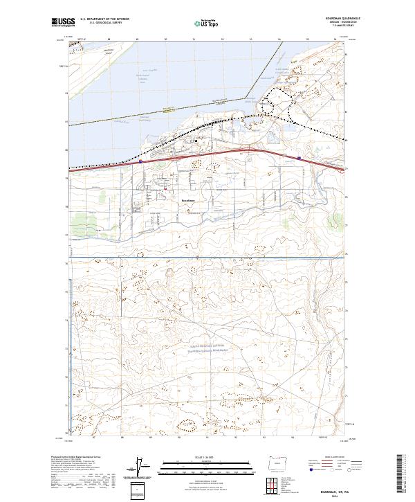
2024 Map of Boardman
USGS Topo · Published 2024About this map
Boardman sits at the intersection of irrigation history and military geography, positioned along the southern banks of the Columbia River in Morrow County. The landscape is defined by the massive Umatilla National Wildlife Refuge, which spans the river and its islands, including Whitcomb Island, and the artificial reservoirs of Lake Umatilla. Inland, the town's grid expands toward the high desert, where the extensive Naval Weapons Systems Training Facility Boardman dominates the southern reaches of the quadrangle.
Find a feature on this map
74 named features on this map. Tap any name to fly to it.
Don’t see what you’re looking for? This feature index may not catch every label — zoom into the map to look around manually.
Map Details
Editions of this 2024 Boardman Map
This is the sole edition of this map. No revisions or reprints were ever made.
Other maps of this area

1906 · Blalock Island
USGS Topo · 1:125,000

1908 · Blalock Island
USGS Topo · 1:125,000

1953 · Pendleton
USGS Topo · 1:250,000

1956 · Pendleton
USGS Topo · 1:250,000

1962 · Canoe Ridge
USGS Topo · 1:24,000

1962 · Blalock Island
USGS Topo · 1:24,000

1962 · Paterson
USGS Topo · 1:24,000

1962 · Boardman
USGS Topo · 1:24,000

1962 · Clarke
USGS Topo · 1:24,000

1962 · Crow Butte
USGS Topo · 1:24,000