
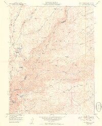
2012 Map of Boards Crossing
USGS Topo · Published 2012About this map
The North Fork Stanislaus River serves as the central artery for this mountainous region of Tuolumne County, where the settlement of Boards Crossing marks a key historical crossing point. The map illustrates a landscape shaped by seasonal use and recreation, with established sites like the Cottage Springs Picnic Area and Sourgrass Campground dotting the drainages. Higher elevations are marked by landmarks such as Thunder Hill and Shumake Knoll, while more remote pockets of the Stanislaus National Forest reveal the presence of high-country outposts like Brown Girl Cabin and Whittles Upper Camp.
Find a feature on this map
37 named features on this map. Tap any name to fly to it.
Don’t see what you’re looking for? This feature index may not catch every label — zoom into the map to look around manually.
Map Details
Editions of this 2012 Boards Crossing Map
This is the sole edition of this map. No revisions or reprints were ever made.
Other maps of this area

1891 · Big Trees
USGS Topo · 1:125,000

1894 · Big Trees
USGS Topo · 1:125,000

1897 · Big Trees
USGS Topo · 1:125,000

1901 · Big Trees
USGS Topo · 1:125,000

1947 · Sacramento
USGS Topo · 1:250,000

1948 · Sacramento
USGS Topo · 1:250,000

1948 · Columbia
USGS Topo · 1:62,500

1948 · Stanislaus
USGS Topo · 1:24,000
1949 · Stanislaus
USGS Topo · 1:24,000

1956 · Sacramento
USGS Topo · 1:250,000