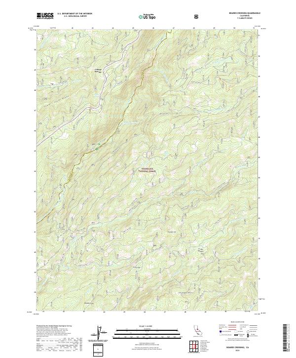
2021 Map of Boards Crossing
USGS Topo · Published 2021About this map
The Stanislaus National Forest defines the rugged geography of this 2021 survey, where the administrative boundary between Calaveras and Tuolumne counties follows the winding course of the N Fork Stanislaus River. Small mountain settlements like Cottage Springs and Cedar Flat are connected by a network of forest service routes, including the notably named Hells Half Acre Rd. The terrain is characterized by dramatic elevation changes from Summit Level Ridge down to the numerous creek drainages that feed the larger river systems.
Find a feature on this map
48 named features on this map. Tap any name to fly to it.
Don’t see what you’re looking for? This feature index may not catch every label — zoom into the map to look around manually.
Map Details
Editions of this 2021 Boards Crossing Map
This is the sole edition of this map. No revisions or reprints were ever made.
Other maps of this area

1891 · Big Trees
USGS Topo · 1:125,000

1894 · Big Trees
USGS Topo · 1:125,000

1897 · Big Trees
USGS Topo · 1:125,000

1901 · Big Trees
USGS Topo · 1:125,000

1947 · Sacramento
USGS Topo · 1:250,000

1948 · Sacramento
USGS Topo · 1:250,000

1948 · Columbia
USGS Topo · 1:62,500

1948 · Stanislaus
USGS Topo · 1:24,000
1949 · Stanislaus
USGS Topo · 1:24,000

1956 · Sacramento
USGS Topo · 1:250,000