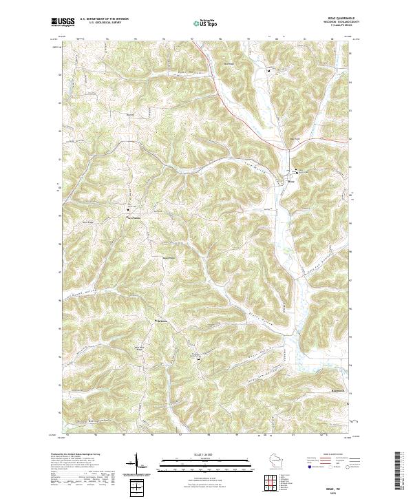
2022 Map of Boaz
USGS Topo · Published 2022About this map
Boaz sits at the convergence of several valley systems in Richland County, where Mill Cr and its tributaries have carved a complex landscape of ridges and hollows. This 2022 survey captures the rural character of the Driftless Area, where settlement patterns strictly follow the topography. Small communities like Five Points and Basswood are connected by a network of winding county roads that trace the high ground of Mid Ridge, West Ridge, and Maple Ridge. The map reveals a high density of rural burial sites, including the Richwood Methodist Cem and Saint Martin Cem, which often serve as the primary remaining landmarks of early pioneer church congregations. The intricate drainage network, including W Br Mill Cr and Byrds Cr, defines the boundaries of numerous named geographical features like Dieter Hollow, Gault Hollow, and Core Hollow, illustrating how families historically organized their lands around these distinct topographical units.
Find a feature on this map
84 named features on this map. Tap any name to fly to it.
Don’t see what you’re looking for? This feature index may not catch every label — zoom into the map to look around manually.
Map Details
Editions of this 2022 Boaz Map
This is the sole edition of this map. No revisions or reprints were ever made.
Other maps of this area

1905 · Richland Center
USGS Topo · 1:125,000

1933 · Boaz
USGS Topo · 1:62,500

1933 · Boscobel
USGS Topo · 1:62,500

1958 · La Crosse
USGS Topo · 1:250,000

1960 · Richland Center
USGS Topo · 1:62,500

1960 · Muscoda
USGS Topo · 1:62,500

1961 · La Crosse
USGS Topo · 1:250,000

1965 · La Crosse
USGS Topo · 1:250,000

1966 · Boaz
USGS Topo · 1:62,500
1967 · Boscobel
USGS Topo · 1:62,500