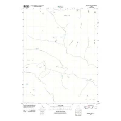
2011 Map of Bob Hill Knoll
USGS Topo · Published 2011About this map
Bob Hill Knoll stands as a central landmark in this portion of Emery County, overseeing a landscape defined by seasonal water sources and distinct landforms. The region is characterized by high benches and deep draws, including Huff Bench and the winding Furniture Draw. Settled features are sparse, though the presence of the Buckhorn Corral near Buckhorn Flat points to the area's grazing history. Access is provided by a network of unimproved roads like the Green River Cutoff and Cedar Overlook Rd. Water is the defining factor for movement here, marked by isolated points such as Joe Jensen Spring, Swazy Hole, and the Dog Ponds. To the south, the terrain descends toward The Wedge, reflecting the dramatic shifts in elevation typical of the San Rafael Swell's periphery.
Find a feature on this map
37 named features on this map. Tap any name to fly to it.
Don’t see what you’re looking for? This feature index may not catch every label — zoom into the map to look around manually.
Map Details
Editions of this 2011 Bob Hill Knoll Map
This is the sole edition of this map. No revisions or reprints were ever made.
Other maps of this area

1886 · Price River
USGS Topo · 1:250,000

1896 · Price River
USGS Topo · 1:250,000

1953 · Wilsonville SE
USGS Topo · 1:24,000

1953 · Red Plateau SE
USGS Topo · 1:24,000

1953 · Red Plateau SW
USGS Topo · 1:24,000
1954 · Wilsonville SE
USGS Topo · 1:24,000

1956 · Price
USGS Topo · 1:250,000

1960 · Price
USGS Topo · 1:250,000

1962 · Price
USGS Topo · 1:250,000
1969 · Chimney Rock
USGS Topo · 1:24,000