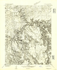
1954 Map of Wilsonville SE
USGS Topo · Published 1954About this map
The San Rafael River carves a deep, winding path through this portion of Emery County, defining the complex topography of the San Rafael Swell. This 1954 preliminary edition, based on 1951 aerial photography, focuses on the dramatic geological formations of the region, including the prominent overlook known as The Wedge. To the south, the landscape is marked by the distinctive Sid and Charley pinnacles and the drainage systems of Little Ocean Draw and Saddle Horse Canyon. The map records a wild, unpopulated territory where vertical relief is the primary feature, captured before the full completion of the 15-minute series for this area. A single survey marker, Vabm 6610, provides a point of geodetic reference in an otherwise remote expanse of canyons and high desert plateaus.
Find a feature on this map
9 named features on this map. Tap any name to fly to it.
Don’t see what you’re looking for? This feature index may not catch every label — zoom into the map to look around manually.
Map Details
Editions of this 1954 Wilsonville SE Map
This is the sole edition of this map. No revisions or reprints were ever made.
Other maps of this area

1885 · San Rafael
USGS Topo · 1:250,000

1886 · Price River
USGS Topo · 1:250,000

1896 · Price River
USGS Topo · 1:250,000

1952 · San Rafael Knob
USGS Topo · 1:62,500

1953 · Wilsonville SE
USGS Topo · 1:24,000

1953 · Red Plateau SW
USGS Topo · 1:24,000

1954 · Stinking Spring Creek 1 NW
USGS Topo · 1:24,000

1954 · Stinking Spring Creek 2 NE
USGS Topo · 1:24,000
1954 · Stinking Spring Creek 2 NW
USGS Topo · 1:24,000
1954 · The Wickiup
USGS Topo · 1:62,500