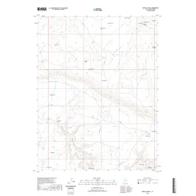
2020 Map of Bob Hill Knoll
USGS Topo · Published 2020About this map
Bob Hill Knoll rises above the arid tablelands of Emery County, defining a landscape marked by deep drainages and isolated water sources. This 2020 survey details the complex network of canyons and hollows that characterize this portion of the San Rafael Swell, where terrain features like The Wedge and Cedar Mtn overlook significant corridors such as Buckhorn Wash. The presence of numerous named springs, including Joe Jensen Spring and Squaw Spring, indicates the vital importance of water in this high-desert environment, while features like Huff Hollow and Gooseberry Hollow reveal a tradition of family-named landmarks across the flats. Roads like Co RD 401 and Lower Wedge Rd provide modern access through the winding geography of Calf Canyon and the broad expanses of Buckhorn Flat, connecting the higher benches with the lower draws and washes.
Find a feature on this map
38 named features on this map. Tap any name to fly to it.
Don’t see what you’re looking for? This feature index may not catch every label — zoom into the map to look around manually.
Map Details
Editions of this 2020 Bob Hill Knoll Map
This is the sole edition of this map. No revisions or reprints were ever made.
Other maps of this area

1886 · Price River
USGS Topo · 1:250,000

1896 · Price River
USGS Topo · 1:250,000

1953 · Wilsonville SE
USGS Topo · 1:24,000

1953 · Red Plateau SE
USGS Topo · 1:24,000

1953 · Red Plateau SW
USGS Topo · 1:24,000
1954 · Wilsonville SE
USGS Topo · 1:24,000

1956 · Price
USGS Topo · 1:250,000

1960 · Price
USGS Topo · 1:250,000

1962 · Price
USGS Topo · 1:250,000
1969 · Chimney Rock
USGS Topo · 1:24,000