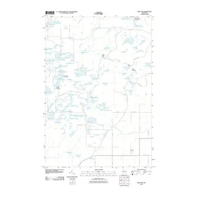
2010 Map of Bob Lake
USGS Topo · Published 2010About this map
Baldy Mountain stands as a prominent elevation in this lake-strewn portion of Chippewa County, where the landscape is defined by an intricate network of flowages and glacial remains. The early 21st-century topography highlights several water management features, including the Conley E3663 1 Dam and large impoundments like Willow Creek Flowage Number Three. The area is a significant recreational and conservation corridor, traced by the Ice Age Trl and various secondary paths such as the Hickory Ridge Trl and High Ridge Trl. In the southeastern corner, the Cleveland Cemetery provides a point of genealogical interest near County Hwy R. Educational and youth retreats are established here as well, with Camp Nawakwa and Camp Norwesco situated among the numerous water bodies, which range from the sprawling Long Lake to the smaller, family-named Riley Lake and Pauls Lake.
Find a feature on this map
114 named features on this map. Tap any name to fly to it.
Don’t see what you’re looking for? This feature index may not catch every label — zoom into the map to look around manually.
Map Details
Editions of this 2010 Bob Lake Map
This is the sole edition of this map. No revisions or reprints were ever made.
Other maps of this area

1948 · Weyerhauser
USGS Topo · 1:48,000

1948 · Ladysmith
USGS Topo · 1:48,000

1949 · Bloomer
USGS Topo · 1:62,500

1950 · Weyerhauser
USGS Topo · 1:48,000

1950 · Ladysmith
USGS Topo · 1:48,000

1951 · Bloomer
USGS Topo · 1:62,500

1951 · Cornell
USGS Topo · 1:62,500

1953 · Rice Lake
USGS Topo · 1:250,000

1959 · Rice Lake
USGS Topo · 1:250,000
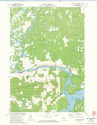
1971 · Flambeau Ridge
USGS Topo · 1:24,000