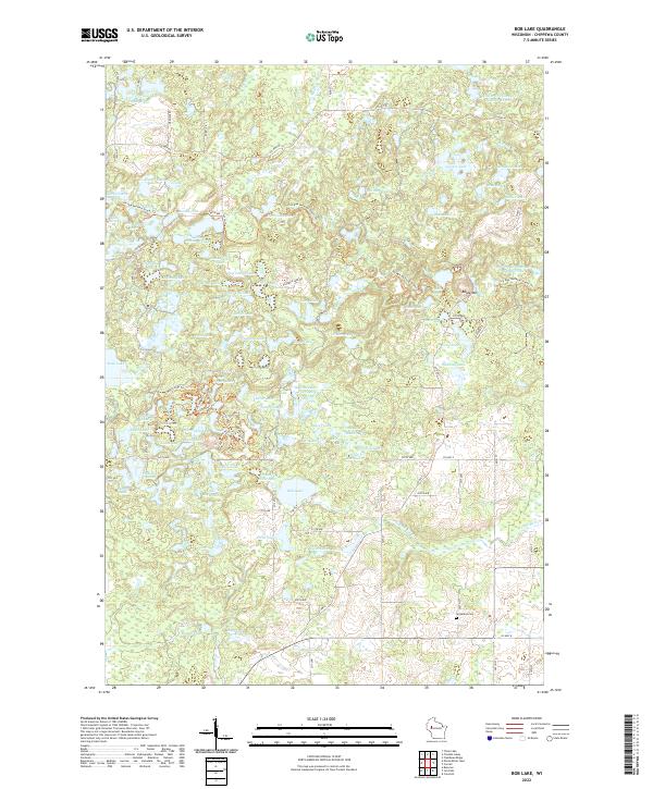
2022 Map of Bob Lake
USGS Topo · Published 2022About this map
Bob Lake and the surrounding glacial terrain of Chippewa County are meticulously documented in this 2022 survey. The landscape is defined by an intricate network of kettle lakes and flowages, reflecting the post-glacial topography of northern Wisconsin. The Ice Age National Scenic Trl winds through the region, passing notable elevations like Baldy Mtn and traversing between countless water bodies including Knickerbocker Lake, Highland Lake, and Lowland Lake. A modest rural infrastructure is represented by roads like Co HWY M and Co HWY E, which connect isolated homesteads and recreation areas. For those tracing local history or genealogy, the presence of Cleveland Cem near the southern edge of the map offers a specific point of interest in this otherwise lake-dotted wilderness. The map captures a contemporary look at a landscape where the natural hydrography, from Hay Meadow Flowage to Riley Lake, remains the primary geographic feature.
Find a feature on this map
112 named features on this map. Tap any name to fly to it.
Don’t see what you’re looking for? This feature index may not catch every label — zoom into the map to look around manually.
Map Details
Editions of this 2022 Bob Lake Map
This is the sole edition of this map. No revisions or reprints were ever made.
Other maps of this area

1948 · Weyerhauser
USGS Topo · 1:48,000

1948 · Ladysmith
USGS Topo · 1:48,000

1949 · Bloomer
USGS Topo · 1:62,500

1950 · Weyerhauser
USGS Topo · 1:48,000

1950 · Ladysmith
USGS Topo · 1:48,000

1951 · Bloomer
USGS Topo · 1:62,500

1951 · Cornell
USGS Topo · 1:62,500

1953 · Rice Lake
USGS Topo · 1:250,000

1959 · Rice Lake
USGS Topo · 1:250,000
1971 · Flambeau Ridge
USGS Topo · 1:24,000