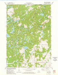
1975 Map of Bob Lake
USGS Topo · Published 1978About this map
Glacial topography and conservation efforts dominate this mid-1970s survey of the Chippewa Moraine. Much of the northwest is protected within the Ice Age National Scientific Reserve, a landscape defined by thousands of years of geological activity that left behind a dense cluster of kettle lakes, including Plummer Lake, Dumke Lake, and the Triple Lakes. This area was a focal point for early environmental preservation and youth recreation, evidenced by Camp Norwesco and Camp Nawakwa.
Find a feature on this map
92 named features on this map. Tap any name to fly to it.
Don’t see what you’re looking for? This feature index may not catch every label — zoom into the map to look around manually.
Map Details
Editions of this 1975 Bob Lake Map
This is the sole edition of this map. No revisions or reprints were ever made.
Other maps of this area

1948 · Weyerhauser
USGS Topo · 1:48,000

1948 · Ladysmith
USGS Topo · 1:48,000

1949 · Bloomer
USGS Topo · 1:62,500

1950 · Weyerhauser
USGS Topo · 1:48,000

1950 · Ladysmith
USGS Topo · 1:48,000

1951 · Bloomer
USGS Topo · 1:62,500

1951 · Cornell
USGS Topo · 1:62,500

1953 · Rice Lake
USGS Topo · 1:250,000

1959 · Rice Lake
USGS Topo · 1:250,000
1971 · Flambeau Ridge
USGS Topo · 1:24,000