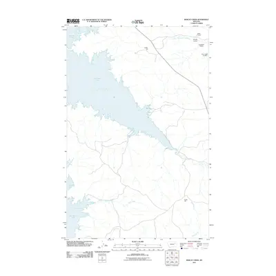
2011 Map of Bobcat Creek
USGS Topo · Published 2011About this map
Fort Peck Lake dominates this portion of McCone County, creating an intricate shoreline defined by extensive inlets and bays. The landscape is characterized by a complex network of coulees and creeks that drain into the reservoir, reflecting the dramatic geography of northeastern Montana. Notable water features include Milk Coulee Bay to the north and the expansive Bear Creek Bay further south.
Find a feature on this map
15 named features on this map. Tap any name to fly to it.
Don’t see what you’re looking for? This feature index may not catch every label — zoom into the map to look around manually.
Map Details
Editions of this 2011 Bobcat Creek Map
This is the sole edition of this map. No revisions or reprints were ever made.
Other maps of this area

1914 · Nashua
USGS Topo · 1:62,500

1915 · Frazer
USGS Topo · 1:62,500

1916 · Nashua
USGS Topo · 1:62,500

1954 · Jordan
USGS Topo · 1:250,000

1954 · Glasgow
USGS Topo · 1:250,000

1956 · Jordan
USGS Topo · 1:250,000

1957 · Glasgow
USGS Topo · 1:250,000

1958 · Glasgow
USGS Topo · 1:250,000

1958 · Jordan
USGS Topo · 1:250,000

1964 · Jordan
USGS Topo · 1:250,000