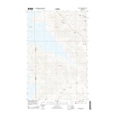
2014 Map of Bobcat Creek
USGS Topo · Published 2014About this map
Fort Peck Lake dominates the western shoreline of this landscape along the border of McCone and Garfield counties. The terrain is defined by a dense network of coulees and drainage systems that feed into the reservoir, including Struple Coulee, Humphrey Coulee, and Polecat Coulee. High points like Indian Hill and Lucky Hill provide vantage points over the surrounding breaks. This 2014 survey documents the modern layout of the northern plains, where ranching infrastructure and remote roadways such as Mt-24 and Bobcat Creek Rd navigate the complex topography. Named features like Plum Patch Coulee and Jorgensen Coulee reflect the local nomenclature of the Missouri River country, highlighting the importance of seasonal watercourses like Bobcat Cr and Bear Cr in this arid environment.
Find a feature on this map
24 named features on this map. Tap any name to fly to it.
Don’t see what you’re looking for? This feature index may not catch every label — zoom into the map to look around manually.
Map Details
Editions of this 2014 Bobcat Creek Map
This is the sole edition of this map. No revisions or reprints were ever made.
Other maps of this area

1914 · Nashua
USGS Topo · 1:62,500

1915 · Frazer
USGS Topo · 1:62,500

1916 · Nashua
USGS Topo · 1:62,500

1954 · Jordan
USGS Topo · 1:250,000

1954 · Glasgow
USGS Topo · 1:250,000

1956 · Jordan
USGS Topo · 1:250,000

1957 · Glasgow
USGS Topo · 1:250,000

1958 · Glasgow
USGS Topo · 1:250,000

1958 · Jordan
USGS Topo · 1:250,000

1964 · Jordan
USGS Topo · 1:250,000