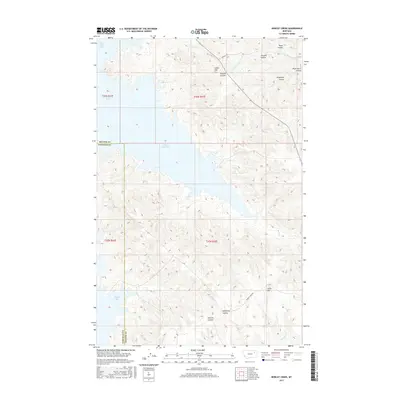
2017 Map of Bobcat Creek
USGS Topo · Published 2017About this map
Fort Peck Lake dominates this portion of the Missouri River country, its sprawling fingers forming Bear Creek Bay, Milk Coulee Bay, and Bobcat Bay along the boundary of McCone and Garfield counties. The shoreline is defined by a complex network of deep ravines and drainages, where named features such as Hilliard Coulee and Humphrey Coulee channel seasonal runoff into the reservoir. This modern survey illustrates the intersection of vast water infrastructure with the historic land management system of the Montana plains. Higher ground is marked by distinct landmarks like Indian Hill and Lucky Hill, while local travel is facilitated by rural corridors including Nickels Rd and Bobcat Creek Rd. The landscape reflects a transition from the elevated prairie breaks down to the submerged valleys of the river system.
Find a feature on this map
26 named features on this map. Tap any name to fly to it.
Don’t see what you’re looking for? This feature index may not catch every label — zoom into the map to look around manually.
Map Details
Editions of this 2017 Bobcat Creek Map
This is the sole edition of this map. No revisions or reprints were ever made.
Other maps of this area

1914 · Nashua
USGS Topo · 1:62,500

1915 · Frazer
USGS Topo · 1:62,500

1916 · Nashua
USGS Topo · 1:62,500

1954 · Jordan
USGS Topo · 1:250,000

1954 · Glasgow
USGS Topo · 1:250,000

1956 · Jordan
USGS Topo · 1:250,000

1957 · Glasgow
USGS Topo · 1:250,000

1958 · Glasgow
USGS Topo · 1:250,000

1958 · Jordan
USGS Topo · 1:250,000

1964 · Jordan
USGS Topo · 1:250,000