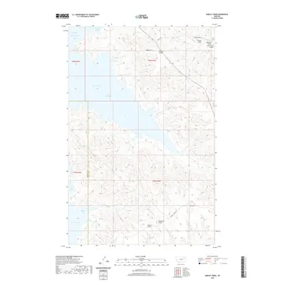
2020 Map of Bobcat Creek
USGS Topo · Published 2020About this map
Fort Peck Lake dominates the western half of this landscape, its intricate shoreline creating deeply recessed inlets like Milk Coulee Bay, Bear Creek Bay, and Bobcat Bay. The terrain transitions from these quiet waters into a complex network of coulees and high ground along the Garfield County and McCone County border. This area is defined by its drainage patterns, where seasonal flows like Bobcat Cr and Spring Cr have carved the land into distinct features such as Humphrey Coulee and Plum Patch Coulee.
Find a feature on this map
25 named features on this map. Tap any name to fly to it.
Don’t see what you’re looking for? This feature index may not catch every label — zoom into the map to look around manually.
Map Details
Editions of this 2020 Bobcat Creek Map
This is the sole edition of this map. No revisions or reprints were ever made.
Other maps of this area

1914 · Nashua
USGS Topo · 1:62,500

1915 · Frazer
USGS Topo · 1:62,500

1916 · Nashua
USGS Topo · 1:62,500

1954 · Jordan
USGS Topo · 1:250,000

1954 · Glasgow
USGS Topo · 1:250,000

1956 · Jordan
USGS Topo · 1:250,000

1957 · Glasgow
USGS Topo · 1:250,000

1958 · Glasgow
USGS Topo · 1:250,000

1958 · Jordan
USGS Topo · 1:250,000

1964 · Jordan
USGS Topo · 1:250,000