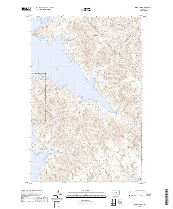
2024 Map of Bobcat Creek
USGS Topo · Published 2024About this map
The Charles M Russell National Wildlife Refuge dominates this section of the Missouri River country, protecting a complex landscape of coulees and breaks along the northern shores of Fort Peck Lake. The topography is defined by sharp elevation changes from the lakefront up to Indian Hill and Lucky Hill, cut by numerous drainage systems such as Hilliard Coulee, Struple Coulee, and Jorgensen Coulee. This 2024 map illustrates the border between Garfield and McCone counties where it intersects the water, showing a territory largely shaped by the reservoir and the federal wildlife refuge established to manage the surrounding prairie and river-bottom habitats.
Find a feature on this map
21 named features on this map. Tap any name to fly to it.
Don’t see what you’re looking for? This feature index may not catch every label — zoom into the map to look around manually.
Map Details
Editions of this 2024 Bobcat Creek Map
This is the sole edition of this map. No revisions or reprints were ever made.
Other maps of this area

1914 · Nashua
USGS Topo · 1:62,500

1915 · Frazer
USGS Topo · 1:62,500

1916 · Nashua
USGS Topo · 1:62,500

1954 · Jordan
USGS Topo · 1:250,000

1954 · Glasgow
USGS Topo · 1:250,000

1956 · Jordan
USGS Topo · 1:250,000

1957 · Glasgow
USGS Topo · 1:250,000

1958 · Glasgow
USGS Topo · 1:250,000

1958 · Jordan
USGS Topo · 1:250,000

1964 · Jordan
USGS Topo · 1:250,000