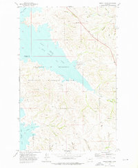
1972 Map of Bobcat Creek
USGS Topo · Published 1976About this map
Fort Peck Lake dominates this 1970s landscape, where its irregular shoreline forms deep inlets like Milk Coulee Bay and Bobcat Bay. Much of the territory falls within the Charles M Russell National Wildlife Range, a massive conservation area established along the Missouri River breaks. The topography is defined by a dense network of coulees—dry creek beds that channel seasonal runoff—including Hilliard Coulee, Struple Coulee, and Humphrey Coulee.
Find a feature on this map
26 named features on this map. Tap any name to fly to it.
Don’t see what you’re looking for? This feature index may not catch every label — zoom into the map to look around manually.
Map Details
Editions of this 1972 Bobcat Creek Map
This is the sole edition of this map. No revisions or reprints were ever made.
Other maps of this area

1914 · Nashua
USGS Topo · 1:62,500

1915 · Frazer
USGS Topo · 1:62,500

1916 · Nashua
USGS Topo · 1:62,500

1954 · Jordan
USGS Topo · 1:250,000

1954 · Glasgow
USGS Topo · 1:250,000

1956 · Jordan
USGS Topo · 1:250,000

1957 · Glasgow
USGS Topo · 1:250,000

1958 · Glasgow
USGS Topo · 1:250,000

1958 · Jordan
USGS Topo · 1:250,000

1964 · Jordan
USGS Topo · 1:250,000