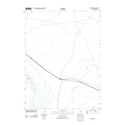
2012 Map of Bobs Flat
USGS Topo · Published 2012About this map
Whirlwind Valley and the sprawling basin of Bobs Flat define this section of the Great Basin, where the meandering course of the Humboldt River cuts across the southwest corner. The landscape is characterized by wide-open desert terrain punctuated by seasonal watercourses like Bob Creek and Mack Creek. Evidence of local land use is centered around Weber Ranch in the northeast, while the corridor near Dunphy marks a vital transportation artery through the region. Significant topographical features like Welches Cyn channel toward the valley floor, illustrating the drainage patterns that have shaped this portion of Eureka County. This survey reflects the modern infrastructure and rural land holdings that persist in this sparsely populated Nevada interior.
Find a feature on this map
8 named features on this map. Tap any name to fly to it.
Don’t see what you’re looking for? This feature index may not catch every label — zoom into the map to look around manually.
Map Details
Editions of this 2012 Bobs Flat Map
This is the sole edition of this map. No revisions or reprints were ever made.
Other maps of this area

1955 · Winnemucca
USGS Topo · 1:250,000

1957 · Dunphy
USGS Topo · 1:62,500

1957 · Beowawe
USGS Topo · 1:62,500

1958 · Winnemucca
USGS Topo · 1:250,000

1962 · Winnemucca
USGS Topo · 1:250,000

1965 · Sheep Creek Range SE
USGS Topo · 1:24,000

1968 · Rodeo Creek SW
USGS Topo · 1:24,000

1968 · Welches Canyon
USGS Topo · 1:24,000

1985 · Scotts Gulch
USGS Topo · 1:24,000
1985 · The Geysers
USGS Topo · 1:24,000