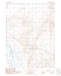
1986 Map of Bobs Flat
USGS Topo · Published 1986About this map
The Humboldt River winds through the western edge of this Nevada landscape, where the historical Old Calif Trail traces an Approximate Route across the desert floor. This 1980s provisional survey illustrates the expansive terrain of Boulder Valley and the northern reaches of Whirlwind Valley, separated by the broad basin of Bobs Flat. The map documents the intersection of historical transit corridors and modern infrastructure, featuring a Wooden Pole Trans Line and a large Pipeline that cuts through the valley. Small markers of land use, such as a Corral and various Sand Areas near the river, punctuate the open space. Water management and drainage are represented by intermittent features like Bob Creek, Mack Creek, and the natural depression of Long Draw, reflecting the arid geography of the Eureka and Nevada county borderlands.
Find a feature on this map
17 named features on this map. Tap any name to fly to it.
Don’t see what you’re looking for? This feature index may not catch every label — zoom into the map to look around manually.
Map Details
Editions of this 1986 Bobs Flat Map
This is the sole edition of this map. No revisions or reprints were ever made.
Other maps of this area

1955 · Winnemucca
USGS Topo · 1:250,000

1957 · Dunphy
USGS Topo · 1:62,500

1957 · Beowawe
USGS Topo · 1:62,500

1958 · Winnemucca
USGS Topo · 1:250,000

1962 · Winnemucca
USGS Topo · 1:250,000

1965 · Sheep Creek Range SE
USGS Topo · 1:24,000

1968 · Rodeo Creek SW
USGS Topo · 1:24,000

1968 · Welches Canyon
USGS Topo · 1:24,000

1985 · Scotts Gulch
USGS Topo · 1:24,000
1985 · The Geysers
USGS Topo · 1:24,000