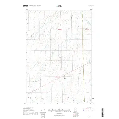
2019 Map of Bock
USGS Topo · Published 2019About this map
Bock serves as the central hub of this northern Minnesota landscape, situated just west of the Mille Lacs Co Kanabec Co boundary line. The surrounding terrain is defined by a complex network of waterways that drainage the region, including Bogus Brook, Vondell Brook, and the S Fork Groundhouse River. These streams move through a low-lying, wetland-rich environment that has historically influenced the placement of roads and homesteads. Local history is anchored by the Borgholm Cem located southwest of the town center. The map reveals a grid of rural routes such as Co Rd 11 and 170th St, which connect various township sections including t39n r26w and t38n r25w, illustrating the intersection of natural drainage and modern agricultural surveying.
Find a feature on this map
59 named features on this map. Tap any name to fly to it.
Don’t see what you’re looking for? This feature index may not catch every label — zoom into the map to look around manually.
Map Details
Editions of this 2019 Bock Map
This is the sole edition of this map. No revisions or reprints were ever made.
Other maps of this area

1953 · Stillwater
USGS Topo · 1:250,000

1955 · Stillwater
USGS Topo · 1:250,000

1958 · Stillwater
USGS Topo · 1:250,000

1961 · Dalbo
USGS Topo · 1:24,000

1961 · Dalbo
USGS Topo · 1:62,500

1965 · Stillwater
USGS Topo · 1:250,000

1968 · Milaca NE
USGS Topo · 1:24,000

1968 · Ann Lake
USGS Topo · 1:24,000

1968 · Milaca
USGS Topo · 1:24,000
1968 · Page
USGS Topo · 1:24,000