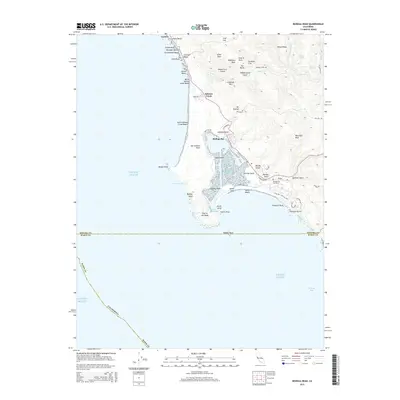
2015 Map of Bodega Head
USGS Topo · Published 2015About this map
The San Andreas Fault traces a significant path through this coastal landscape, separating the rugged cliffs of Bodega Head from the mainland. This geological divide shapes the entire shoreline, creating protected waters like Campbell Cove and the expansive basin of Bodega Bay. Along the northern coast, small residential clusters such as Carmet and Salmon Creek sit atop the bluffs, overlooking a series of beaches including Arched Rock Beach and Miwok Beach.
Find a feature on this map
70 named features on this map. Tap any name to fly to it.
Don’t see what you’re looking for? This feature index may not catch every label — zoom into the map to look around manually.
Map Details
Editions of this 2015 Bodega Head Map
This is the sole edition of this map. No revisions or reprints were ever made.
Other maps of this area

1916 · Point Reyes
USGS Topo · 1:48,000

1918 · Point Reyes
USGS Topo · 1:62,500

1935 · Sebastopol
USGS Topo · 1:48,000

1942 · Sebastopol
USGS Topo · 1:62,500

1942 · Bodega Head
USGS Topo · 1:24,000

1942 · Arched Rock
USGS Topo · 1:24,000

1943 · Duncans Mills
USGS Topo · 1:24,000

1944 · Bodega Head
USGS Topo · 1:31,680
1944 · Arched Rock
USGS Topo · 1:31,680
1945 · Duncans Mills
USGS Topo · 1:31,680