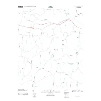
2013 Map of Bodenham
USGS Topo · Published 2013About this map
Bodenham sits at the intersection of several creek-carved hollows in this 2013 topographic study of Giles County. The landscape is characterized by a dense network of local roads and watercourses that drain toward the Fall River area. Notable terrain features like Powder Mill Hill and the prominent high point at Tin Top overlook a series of family-named valleys, including Forsythe Hollow, Johnson Hollow, and Knox Hollow.
Find a feature on this map
115 named features on this map. Tap any name to fly to it.
Don’t see what you’re looking for? This feature index may not catch every label — zoom into the map to look around manually.
Map Details
Editions of this 2013 Bodenham Map
This is the sole edition of this map. No revisions or reprints were ever made.
Other maps of this area

1936 · Milky Way
USGS Topo · 1:24,000

1936 · Aspen Hill
USGS Topo · 1:24,000

1936 · Campbellsville
USGS Topo · 1:24,000

1936 · Lawrenceburg
USGS Topo · 1:24,000

1936 · Ethridge
USGS Topo · 1:24,000

1936 · Pulaski
USGS Topo · 1:24,000

1936 · Bodenham
USGS Topo · 1:24,000

1936 · Appleton
USGS Topo · 1:24,000

1936 · Bonnertown
USGS Topo · 1:24,000
1948 · Appleton
USGS Topo · 1:24,000