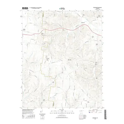
2016 Map of Bodenham
USGS Topo · Published 2016About this map
Bodenham sits at the heart of this landscape where the Lawrence Co and Giles Co lines meet in middle Tennessee. The area is defined by a dense network of hollows and ridges, with water flowing through drainages like Hurricane Cr and Weakley Creek. Rural life is centered around small crossroads and named hills, such as Powder Mill Hill and Tin Top. Local history is preserved in several family and community burial grounds, including Chestnut Grove Cem, Hughes Cem, and Scotts Hill Cem, which are tucked away from the primary thoroughfares like the Pulaski Hwy. Notable natural landmarks such as Copperas Falls and Fall River Spring indicate the area's hydrology, while the presence of Fall River and New Prospect shows the distribution of settlement along the winding county roads that navigate the complex terrain of the Highland Rim.
Find a feature on this map
79 named features on this map. Tap any name to fly to it.
Don’t see what you’re looking for? This feature index may not catch every label — zoom into the map to look around manually.
Map Details
Editions of this 2016 Bodenham Map
This is the sole edition of this map. No revisions or reprints were ever made.
Other maps of this area

1936 · Milky Way
USGS Topo · 1:24,000

1936 · Aspen Hill
USGS Topo · 1:24,000

1936 · Campbellsville
USGS Topo · 1:24,000

1936 · Lawrenceburg
USGS Topo · 1:24,000

1936 · Ethridge
USGS Topo · 1:24,000

1936 · Pulaski
USGS Topo · 1:24,000

1936 · Bodenham
USGS Topo · 1:24,000

1936 · Appleton
USGS Topo · 1:24,000

1936 · Bonnertown
USGS Topo · 1:24,000
1948 · Appleton
USGS Topo · 1:24,000