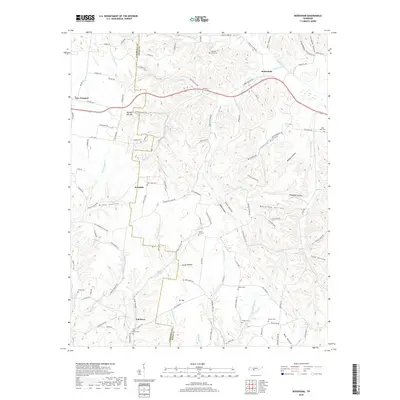
2019 Map of Bodenham
USGS Topo · Published 2019About this map
Bodenham sits at the northern edge of a landscape defined by a complex network of hollows and ridges, situated along the Lawrence Co and Giles Co border. This modern survey reflects a region where traditional rural naming conventions persist, visible in the numerous family-named burial grounds like Choates Creek Cem and Saint Pauls Cem. The terrain is deeply dissected, with prominent features such as Johnson Hollow and Knox Hollow channeling drainage toward significant watercourses like Weakley Creek and Hurricane Cr.
Find a feature on this map
116 named features on this map. Tap any name to fly to it.
Don’t see what you’re looking for? This feature index may not catch every label — zoom into the map to look around manually.
Map Details
Editions of this 2019 Bodenham Map
This is the sole edition of this map. No revisions or reprints were ever made.
Other maps of this area

1936 · Milky Way
USGS Topo · 1:24,000

1936 · Aspen Hill
USGS Topo · 1:24,000

1936 · Campbellsville
USGS Topo · 1:24,000

1936 · Lawrenceburg
USGS Topo · 1:24,000

1936 · Ethridge
USGS Topo · 1:24,000

1936 · Pulaski
USGS Topo · 1:24,000

1936 · Bodenham
USGS Topo · 1:24,000

1936 · Appleton
USGS Topo · 1:24,000

1936 · Bonnertown
USGS Topo · 1:24,000
1948 · Appleton
USGS Topo · 1:24,000