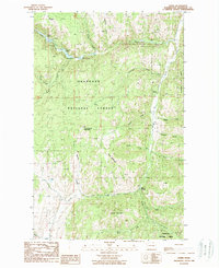
1988 Map of Bodie
USGS Topo · Published 1988About this map
Bodie and Old Toroda sit within the high-elevation terrain of the Okanogan National Forest, reflecting the isolated mining and ranching history of northern Washington. The landscape is defined by massive peaks such as Toroda Mountain, Irene Mountain, and Cumberland Mountain, with a network of drainages including Toroda Creek and Beaver Creek carving through the granite. Local industry is evidenced by a Mine Prospect near Bodie and several other prospects scattered along Meadow Creek, indicating the region's mineral interests late in the twentieth century. Recreation is centered in the northwest corner, where Beth Lake and Beaver Lake provide campgrounds and a Boat Ramp. The map captures a moment of quiet persistence in the Okanogan Highlands, where established forest boundaries meet historic settlement sites and active resource extraction.
Find a feature on this map
34 named features on this map. Tap any name to fly to it.
Don’t see what you’re looking for? This feature index may not catch every label — zoom into the map to look around manually.
Map Details
Editions of this 1988 Bodie Map
This is the sole edition of this map. No revisions or reprints were ever made.
Other maps of this area

1902 · Osoyoos
USGS Topo · 1:125,000

1904 · Osoyoos
USGS Topo · 1:125,000

1904 · Republic
USGS Topo · 1:125,000

1951 · Wauconda
USGS Topo · 1:62,500

1951 · Bodie Mountain
USGS Topo · 1:62,500

1954 · Okanogan
USGS Topo · 1:250,000

1957 · Mt. Bonaparte
USGS Topo · 1:62,500

1957 · Aeneas Valley
USGS Topo · 1:62,500

1958 · Okanogan
USGS Topo · 1:250,000

1958 · Aeneas
USGS Topo · 1:62,500