
1958 Map of Aeneas
USGS Topo · Published 1960About this map
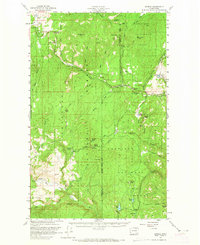
Wauconda Summit serves as a high-altitude anchor for this 1958 survey, where the administrative boundaries of the Okanogan National Forest and Colville National Forest meet. The landscape is defined by its mining and timber heritage, particularly evident in the northeast corner near the Knob Hill Mine and Flag Hill Mines. The settlement of Old Wauconda and the small outpost at Aeneas represent the sparse human footprint in this mountainous region of the Pacific Northwest. Early transportation routes like the Colville Trail and Golden Road cut through the timbered slopes, following natural drainages such as Toroda Creek and the West Fork Sanpoil River. Recreation and water resources are marked by numerous high-country lakes, including Swan Lake and the Copper Lakes, providing a glimpse into the forest's utility before modern expansion.
Find a feature on this map
52 named features on this map. Tap any name to fly to it.
Don’t see what you’re looking for? This feature index may not catch every label — zoom into the map to look around manually.
Map Details
Editions of this 1958 Aeneas Map
3 editions found
Other maps of this area

1902 · Osoyoos
USGS Topo · 1:125,000

1904 · Osoyoos
USGS Topo · 1:125,000

1904 · Republic
USGS Topo · 1:125,000

1948 · Curlew
USGS Topo · 1:62,500

1948 · Republic
USGS Topo · 1:62,500

1951 · Wauconda
USGS Topo · 1:62,500

1951 · Curlew
USGS Topo · 1:62,500

1951 · Bodie Mountain
USGS Topo · 1:62,500

1951 · Republic
USGS Topo · 1:62,500

1952 · Disautel
USGS Topo · 1:62,500