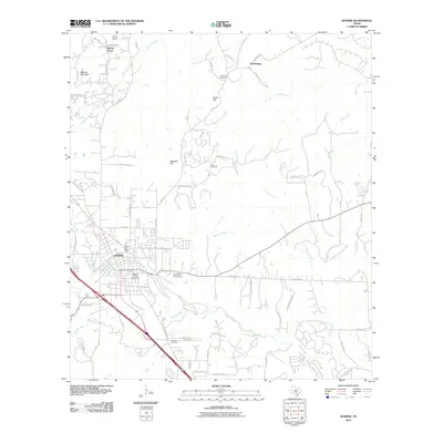
2010 Map of Boerne
USGS Topo · Published 2010About this map
The growing community of Boerne serves as the focal point of this 2010 survey, illustrating the convergence of historical rural roots and modern expansion. The landscape is defined by the winding courses of Cibolo Creek, Frederick Creek, and Currey Creek, which have historically shaped the settlement patterns of this corner of Kendall County. Evidence of early family settlements and agricultural history remains visible through the preservation of several sites, including Kreutzberg Cemetery, Wren Cemetery, and the Howard Cemetery.
Find a feature on this map
69 named features on this map. Tap any name to fly to it.
Don’t see what you’re looking for? This feature index may not catch every label — zoom into the map to look around manually.
Map Details
Editions of this 2010 Boerne Map
This is the sole edition of this map. No revisions or reprints were ever made.
Other maps of this area

1953 · Otis Ridge
USGS Topo · 1:24,000

1953 · Van Raub
USGS Topo · 1:24,000

1954 · San Antonio
USGS Topo · 1:250,000

1956 · Comfort
USGS Topo · 1:62,500

1956 · Medina Lake
USGS Topo · 1:62,500

1957 · Boerne
USGS Topo · 1:62,500

1957 · San Antonio
USGS Topo · 1:250,000

1964 · Waring
USGS Topo · 1:24,000
1964 · Kendalia
USGS Topo · 1:24,000
1964 · Sisterdale
USGS Topo · 1:24,000