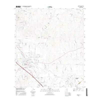
2016 Map of Boerne
USGS Topo · Published 2016About this map
Cibolo Creek and its various tributaries, including Currey Creek and Menger Creek, define the topography of this Hill Country landscape. The city of Boerne serves as a central hub, where the residential street grid gives way to larger ranch properties and limestone hills. Significant elevation changes are marked by landmarks such as Sabinas Mountain and Malakopf Hill, which overlook a network of winding roads like Sisterdale Road and Adler Road.
Find a feature on this map
150 named features on this map. Tap any name to fly to it.
Don’t see what you’re looking for? This feature index may not catch every label — zoom into the map to look around manually.
Map Details
Editions of this 2016 Boerne Map
This is the sole edition of this map. No revisions or reprints were ever made.
Other maps of this area

1953 · Otis Ridge
USGS Topo · 1:24,000

1953 · Van Raub
USGS Topo · 1:24,000

1954 · San Antonio
USGS Topo · 1:250,000

1956 · Comfort
USGS Topo · 1:62,500

1956 · Medina Lake
USGS Topo · 1:62,500

1957 · Boerne
USGS Topo · 1:62,500

1957 · San Antonio
USGS Topo · 1:250,000

1964 · Waring
USGS Topo · 1:24,000
1964 · Kendalia
USGS Topo · 1:24,000
1964 · Sisterdale
USGS Topo · 1:24,000