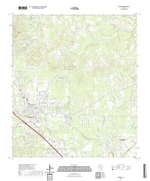
2022 Map of Boerne
USGS Topo · Published 2022About this map
Boerne serves as the focal point of this Kendall County landscape, where the confluence of Cibolo Creek and Currey Cr shaped the early settlement patterns of the Texas Hill Country. The town center is densely documented, featuring the Kendall County Courthouse and several historic burial grounds, including the Holy Angels Cem and the Boerne Cem. The terrain to the north is defined by significant elevations like Sabinas Mtn and Malakopf Hill, which overlook a network of winding roads such as Sisterdale Rd and Walnut Grove Rd.
Find a feature on this map
170 named features on this map. Tap any name to fly to it.
Don’t see what you’re looking for? This feature index may not catch every label — zoom into the map to look around manually.
Map Details
Editions of this 2022 Boerne Map
This is the sole edition of this map. No revisions or reprints were ever made.