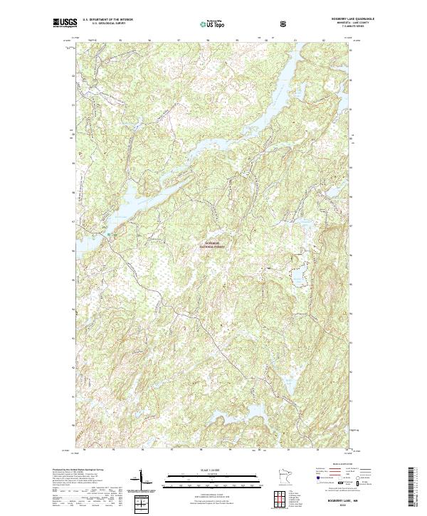
2022 Map of Bogberry Lake
USGS Topo · Published 2022About this map
Superior National Forest encompasses this wilderness landscape in Lake County, where a complex network of waterways and seasonal routes defines the local geography. The South Kawishiwi River flows centrally, connecting a series of glacial lakes including Birch Lake and Bruin Lake. The map reveals a distinct pattern of winter-specific infrastructure, most notably the Old Man Winter Dogsled Trail and several winter-only roads like Crocket Winter and Filson Winter. This reliance on frozen ground for access underscores the seasonal nature of transit in the Minnesota Northwoods. While Minnesota Highway 1 provides modern arterial access in the southern section, much of the interior is navigated via primitive spurs like Spruce Road and forest access points such as Harris Lake Access. The presence of many small, named water bodies like Omaday Lake and Nickel Lake indicates a territory managed for remote recreational and forestry use.
Find a feature on this map
38 named features on this map. Tap any name to fly to it.
Don’t see what you’re looking for? This feature index may not catch every label — zoom into the map to look around manually.
Map Details
Editions of this 2022 Bogberry Lake Map
This is the sole edition of this map. No revisions or reprints were ever made.
Other maps of this area

1933 · Ely
USGS Topo · 1:62,500

1939 · Ely
USGS Topo · 1:62,500

1952 · Babbitt NE
USGS Topo · 1:24,000

1954 · Greenwood Lake
USGS Topo · 1:62,500

1954 · Two Harbors
USGS Topo · 1:250,000

1957 · Two Harbors
USGS Topo · 1:250,000

1957 · Gabbro Lake
USGS Topo · 1:62,500

1958 · Two Harbors
USGS Topo · 1:250,000

1964 · Two Harbors
USGS Topo · 1:250,000
1965 · Ely
USGS Topo · 1:24,000