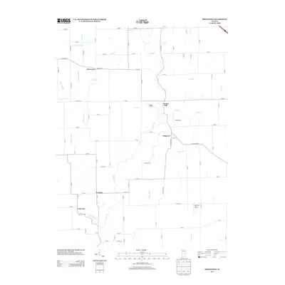
2013 Map of Boggstown
USGS Topo · Published 2013About this map
Sugar Cr meanders southward through this rural Indiana landscape, anchoring a series of small agricultural settlements and rural crossings. The village of Boggstown sits along the creek's eastern bank, positioned near the historic site of The Red Mills and several private airfields, including Gardner Airport and Gray Airport. The drainage patterns here are highly developed, with numerous named waterways such as Little Sugar Cr, Dry Fork, and Snail Cr feeding into the main valley, supplemented by man-made agricultural infrastructure like Gibson Ditch and Cutsinger Ditch.
Find a feature on this map
53 named features on this map. Tap any name to fly to it.
Don’t see what you’re looking for? This feature index may not catch every label — zoom into the map to look around manually.
Map Details
Editions of this 2013 Boggstown Map
This is the sole edition of this map. No revisions or reprints were ever made.
Other maps of this area

1942 · Franklin
USGS Topo · 1:125,000

1942 · Columbus
USGS Topo · 1:125,000

1947 · Franklin
USGS Topo · 1:62,500

1948 · Franklin
USGS Topo · 1:24,000

1948 · Beech Grove
USGS Topo · 1:24,000

1948 · Lewis Creek
USGS Topo · 1:24,000

1948 · Marietta
USGS Topo · 1:24,000

1950 · Franklin
USGS Topo · 1:62,500

1950 · Edinburg
USGS Topo · 1:62,500

1952 · Fountaintown
USGS Topo · 1:24,000