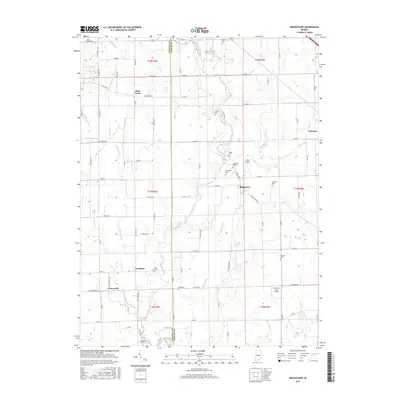
2016 Map of Boggstown
USGS Topo · Published 2016About this map
Sugar Creek winds through the heart of this central Indiana landscape, defining the agricultural and social geography along the border of Johnson and Shelby counties. Small, long-established settlements such as Boggstown, Needham, and Urmeyville serve as local hubs for the surrounding farmsteads. The area is notable for its high density of family and community burial grounds, including the Wiles Cem, Webb Cem, and Gallagher Cem, which provide significant genealogical touchpoints for local history researchers. The drainage patterns are meticulously recorded through a network of ditches and runs like Gibson Ditch and Leather Run. Aviation interests are represented by private strips such as Gray Airport and Cardinals Nest Airport, illustrating the modern utility of these rural landscapes. The map's grid system of county roads, such as Clark School Rd and W Boggstown Rd, reveals the enduring spatial organization of the Indiana countryside.
Find a feature on this map
64 named features on this map. Tap any name to fly to it.
Don’t see what you’re looking for? This feature index may not catch every label — zoom into the map to look around manually.
Map Details
Editions of this 2016 Boggstown Map
This is the sole edition of this map. No revisions or reprints were ever made.
Other maps of this area

1942 · Franklin
USGS Topo · 1:125,000

1942 · Columbus
USGS Topo · 1:125,000

1947 · Franklin
USGS Topo · 1:62,500

1948 · Franklin
USGS Topo · 1:24,000

1948 · Beech Grove
USGS Topo · 1:24,000

1948 · Lewis Creek
USGS Topo · 1:24,000

1948 · Marietta
USGS Topo · 1:24,000

1950 · Franklin
USGS Topo · 1:62,500

1950 · Edinburg
USGS Topo · 1:62,500

1952 · Fountaintown
USGS Topo · 1:24,000